파일:Kingdoms of Israel and Judah map 830.svg.png: 두 판 사이의 차이
Good4Joy
편집 요약 없음 |
편집 요약 없음 |
||
| 1번째 줄: | 1번째 줄: | ||
이스라엘과 주변 국가 - BC 9 세기경 | |||
* 저작권: CC BY-SA 3.0 | * 저작권: CC BY-SA 3.0 | ||
* Oldtidens_Israel_&_Judea.svg: FinnWikiNo derivative work: Richardprins (talk) - Oldtidens_Israel_&_Judea.svg | * Oldtidens_Israel_&_Judea.svg: FinnWikiNo derivative work: Richardprins (talk) - Oldtidens_Israel_&_Judea.svg | ||
* 참고: https://en.wikipedia.org/wiki/History_of_Israel#/media/File:Kingdoms_of_Israel_and_Judah_map_830.svg | * 참고: https://en.wikipedia.org/wiki/History_of_Israel#/media/File:Kingdoms_of_Israel_and_Judah_map_830.svg | ||
2020년 2월 3일 (월) 04:37 판
이스라엘과 주변 국가 - BC 9 세기경
- 저작권: CC BY-SA 3.0
- Oldtidens_Israel_&_Judea.svg: FinnWikiNo derivative work: Richardprins (talk) - Oldtidens_Israel_&_Judea.svg
- 참고: https://en.wikipedia.org/wiki/History_of_Israel#/media/File:Kingdoms_of_Israel_and_Judah_map_830.svg
파일 역사
날짜/시간 링크를 클릭하면 해당 시간의 파일을 볼 수 있습니다.
| 날짜/시간 | 섬네일 | 크기 | 사용자 | 설명 | |
|---|---|---|---|---|---|
| 현재 | 2022년 6월 18일 (토) 15:05 | 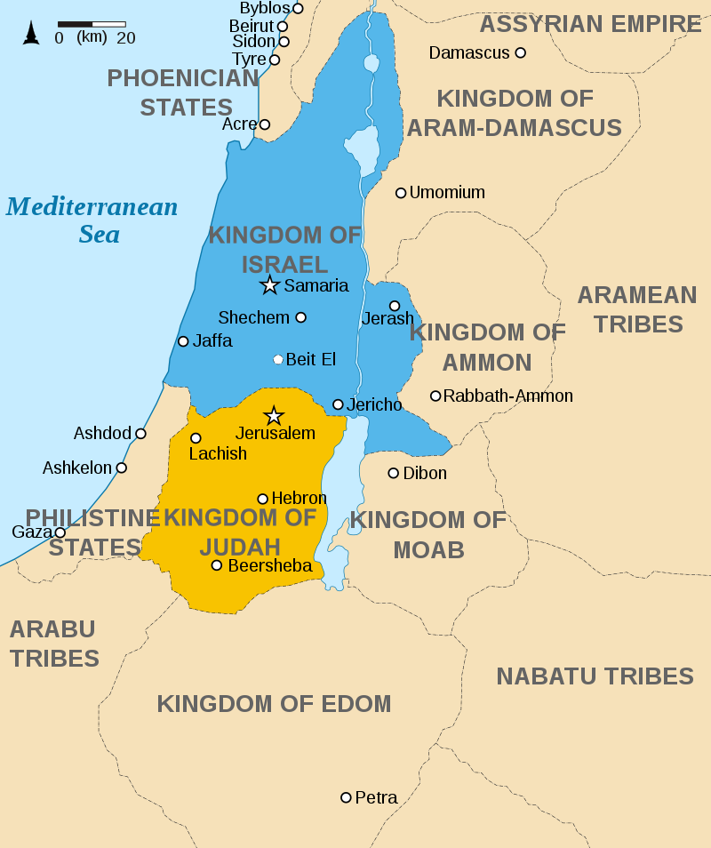 | 800 × 954 (151 KB) | Good4joy (토론 | 기여) | |
| 2020년 1월 30일 (목) 00:03 | 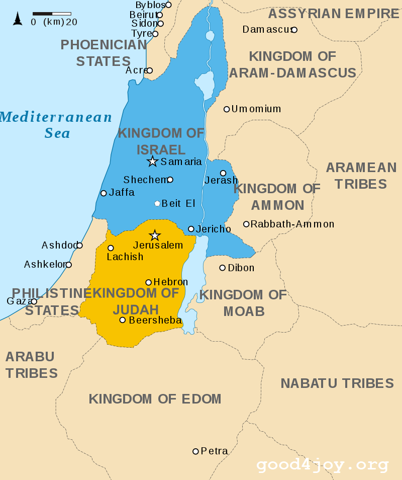 | 800 × 954 (153 KB) | 등대 (토론 | 기여) | https://en.wikipedia.org/wiki/History_of_Israel#/media/File:Kingdoms_of_Israel_and_Judah_map_830.svg |
이 파일을 덮어쓸 수 없습니다.
이 파일을 사용하는 문서
다음 문서 9개가 이 파일을 사용하고 있습니다: