파일:Kingdoms of Israel and Judah map 830.svg.png
Good4Joy
미리 보기 크기: 503 × 600 픽셀
원본 파일 (800 × 954 픽셀, 파일 크기: 151 KB, MIME 종류: image/png)
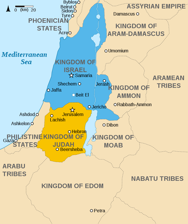
Approximate map showing the Kingdoms of Israel (blue) and Judah (orange), ancient Southern Levant borders and ancient cities such as Urmomium and Jerash. The map shows the region in the 9th century BCE.
- 저작권: CC BY-SA 3.0
- Oldtidens_Israel_&_Judea.svg: FinnWikiNo derivative work: Richardprins (talk) - Oldtidens_Israel_&_Judea.svg
- 참고: https://en.wikipedia.org/wiki/History_of_Israel#/media/File:Kingdoms_of_Israel_and_Judah_map_830.svg
파일 역사
날짜/시간 링크를 클릭하면 해당 시간의 파일을 볼 수 있습니다.
| 날짜/시간 | 섬네일 | 크기 | 사용자 | 설명 | |
|---|---|---|---|---|---|
| 현재 | 2022년 6월 18일 (토) 15:05 | | 800 × 954 (151 KB) | Good4joy (토론 | 기여) | |
| 2020년 1월 30일 (목) 00:03 | 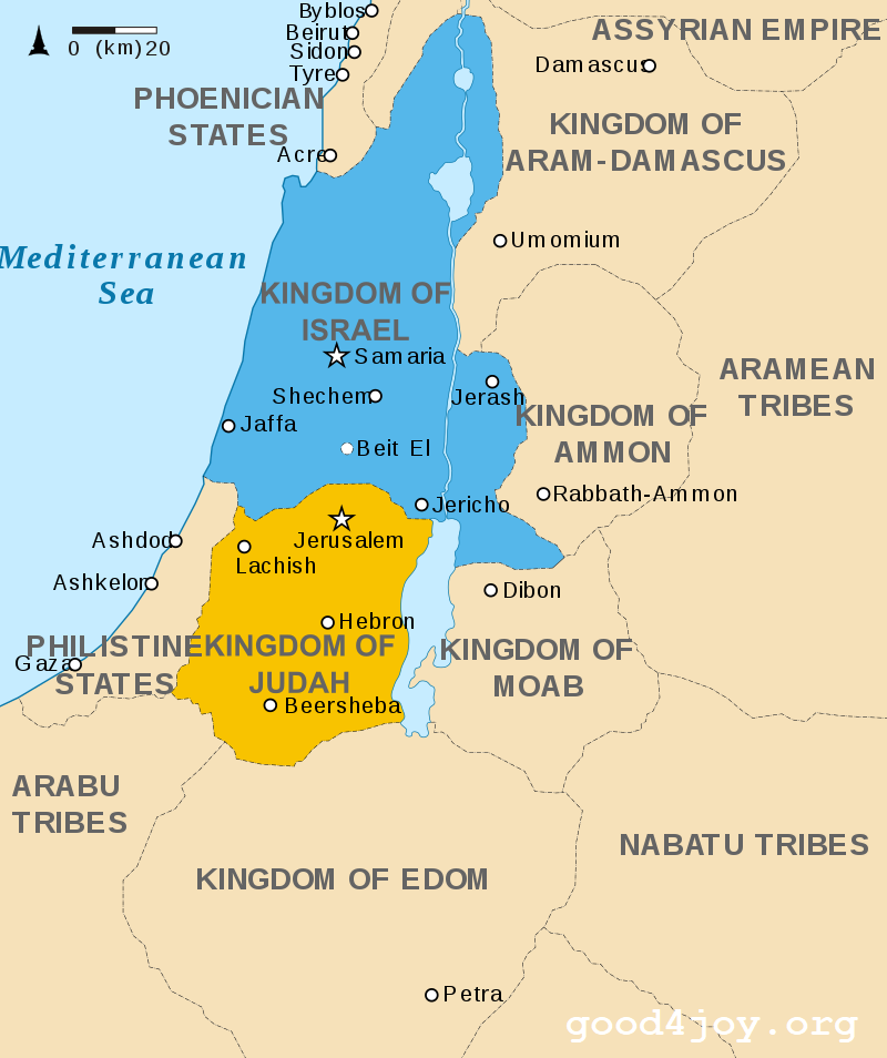 | 800 × 954 (153 KB) | 등대 (토론 | 기여) | https://en.wikipedia.org/wiki/History_of_Israel#/media/File:Kingdoms_of_Israel_and_Judah_map_830.svg |
이 파일을 덮어쓸 수 없습니다.
이 파일을 사용하는 문서
다음 문서 9개가 이 파일을 사용하고 있습니다: