파일:Broad overview of geography relevant to paul of tarsus.png
Good4Joy

미리 보기 크기: 800 × 390 픽셀 다른 해상도: 1,569 × 764 픽셀
원본 파일 (1,569 × 764 픽셀, 파일 크기: 303 KB, MIME 종류: image/png)
Geographic map of Europe during Paul of Tarsus' times, as produced by User:Alecmconroy to illustrate a relevant article and now to be used on its translation.
Copy Right: CC BY-SA 3.0 User:Alecmconroy - Created on en:wikipedia by User:Alecmconroy and ready for transfer to Commons
파일 역사
날짜/시간 링크를 클릭하면 해당 시간의 파일을 볼 수 있습니다.
| 날짜/시간 | 섬네일 | 크기 | 사용자 | 설명 | |
|---|---|---|---|---|---|
| 현재 | 2024년 6월 4일 (화) 04:01 | | 1,569 × 764 (303 KB) | Good4joy (토론 | 기여) | 2020년 6월 19일 (금) 03:48 (UTC) 판으로 되돌림 |
| 2022년 6월 18일 (토) 16:22 | 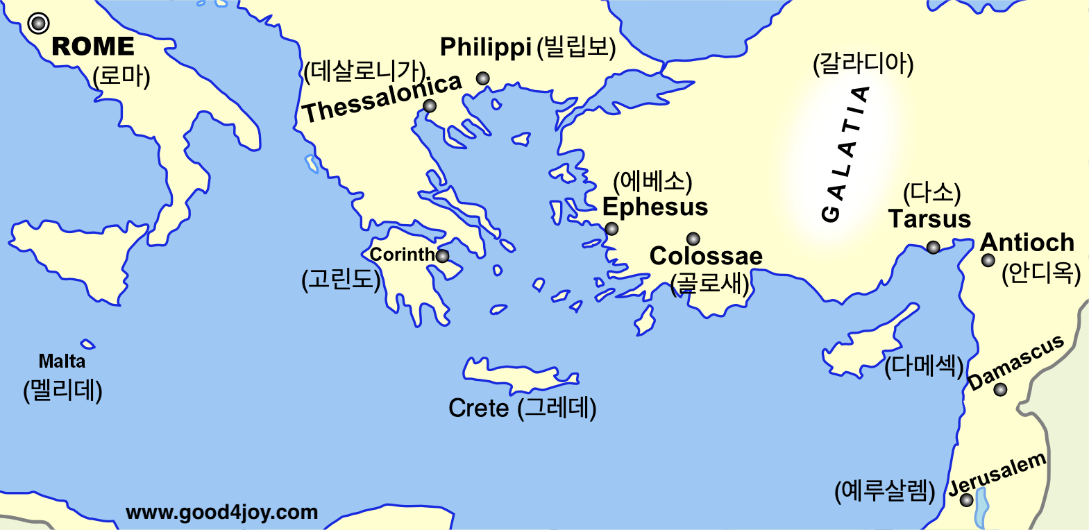 | 1,569 × 764 (310 KB) | Good4joy (토론 | 기여) | ||
| 2020년 6월 19일 (금) 03:48 | 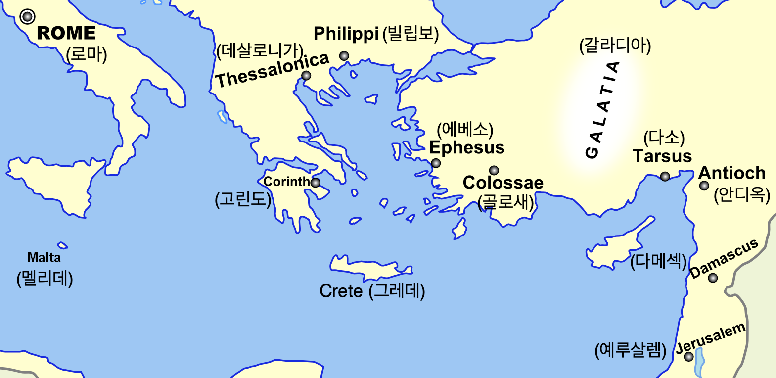 | 1,569 × 764 (303 KB) | Good4joy (토론 | 기여) | Crete 추가 |
이 파일을 덮어쓸 수 없습니다.
이 파일을 사용하는 문서
다음 문서 4개가 이 파일을 사용하고 있습니다: